Back آرتا Arabic آرتا ARZ Арта (Грэцыя) Byelorussian Арта Bulgarian Arta (Grècia) Catalan Árta (lungsod sa Gresya) CEB Arta Czech Arta (Grækenland) Danish Arta (Griechenland) German Άρτα Greek
Arta
Άρτα | |
|---|---|
From top left: The Bridge of Arta over the Arachthos river, Church of Saint Demetrius, Folklore Museum of Arta, statue of Napoleon Zervas, Castle of Arta, clock tower of the Arta Castle, statue of "Tsolias of 1917" by Lefteris Valakas | |
| Coordinates: 39°09′54″N 20°59′15″E / 39.16500°N 20.98750°E | |
| Country | Greece |
| Administrative region | Epirus |
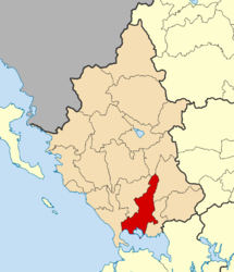
| Regional unit | Arta |
| Government | |
| • Mayor | Christos Tsirogiannis (New Democracy) |
| Area | |
| • Municipality | 457.2 km2 (176.5 sq mi) |
| • Municipal unit | 47.973 km2 (18.522 sq mi) |
| Elevation | 30 m (100 ft) |
| Population (2021)[1] | |
| • Municipality | 41,600 |
| • Density | 91/km2 (240/sq mi) |
| • Municipal unit | 26,999 |
| • Municipal unit density | 560/km2 (1,500/sq mi) |
| • Community | 24,079 |
| Demonym(s) | Artean (Greek: Artinos) |
| Time zone | UTC+2 (EET) |
| • Summer (DST) | UTC+3 (EEST) |
| Postal code | 471 00 |
| Area code(s) | 26810 |
| Vehicle registration | ΑΤ |
| Website | www.arta.gr |
Arta (Greek: Άρτα) is a city in northwestern Greece and capital of the regional unit of Arta, which is part of Epirus region. The city was known in ancient times as Ambracia (Ancient Greek: Ἀμβρακία). Arta is known for the medieval bridge over the Arachthos River. Arta is also known for its ancient sites from the era of Pyrrhus of Epirus and its well-preserved 13th-century castle. Arta's Byzantine history is reflected in its many Byzantine churches; perhaps the best known is the Panagia Paregoretissa (Mother of God the Consoling), built about 1290 by Despot Nikephoros I Komnenos Doukas.
- ^ "Αποτελέσματα Απογραφής Πληθυσμού - Κατοικιών 2021, Μόνιμος Πληθυσμός κατά οικισμό" [Results of the 2021 Population - Housing Census, Permanent population by settlement] (in Greek). Hellenic Statistical Authority. 29 March 2024.
© MMXXIII Rich X Search. We shall prevail. All rights reserved. Rich X Search


